
| Hydrological study and flood discharge of East Gate plan in Riyadh | |
|---|---|
| Location | Janadriyah district, northeast of the city of Riyadh |
| Client | His Royal Highness Prince Khalid bin Faisal bin Abdulaziz Al Saud |
| Duration | 60 days |
| Type of work | Hydrological study |
A brief overview of the work
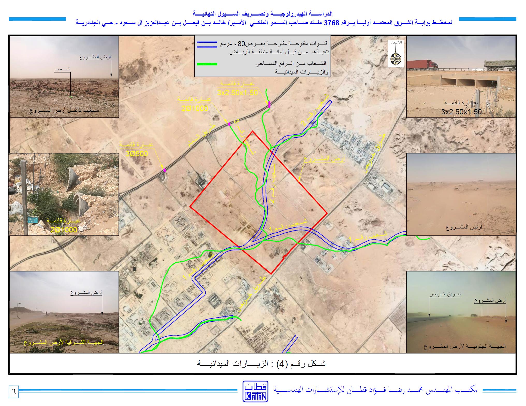
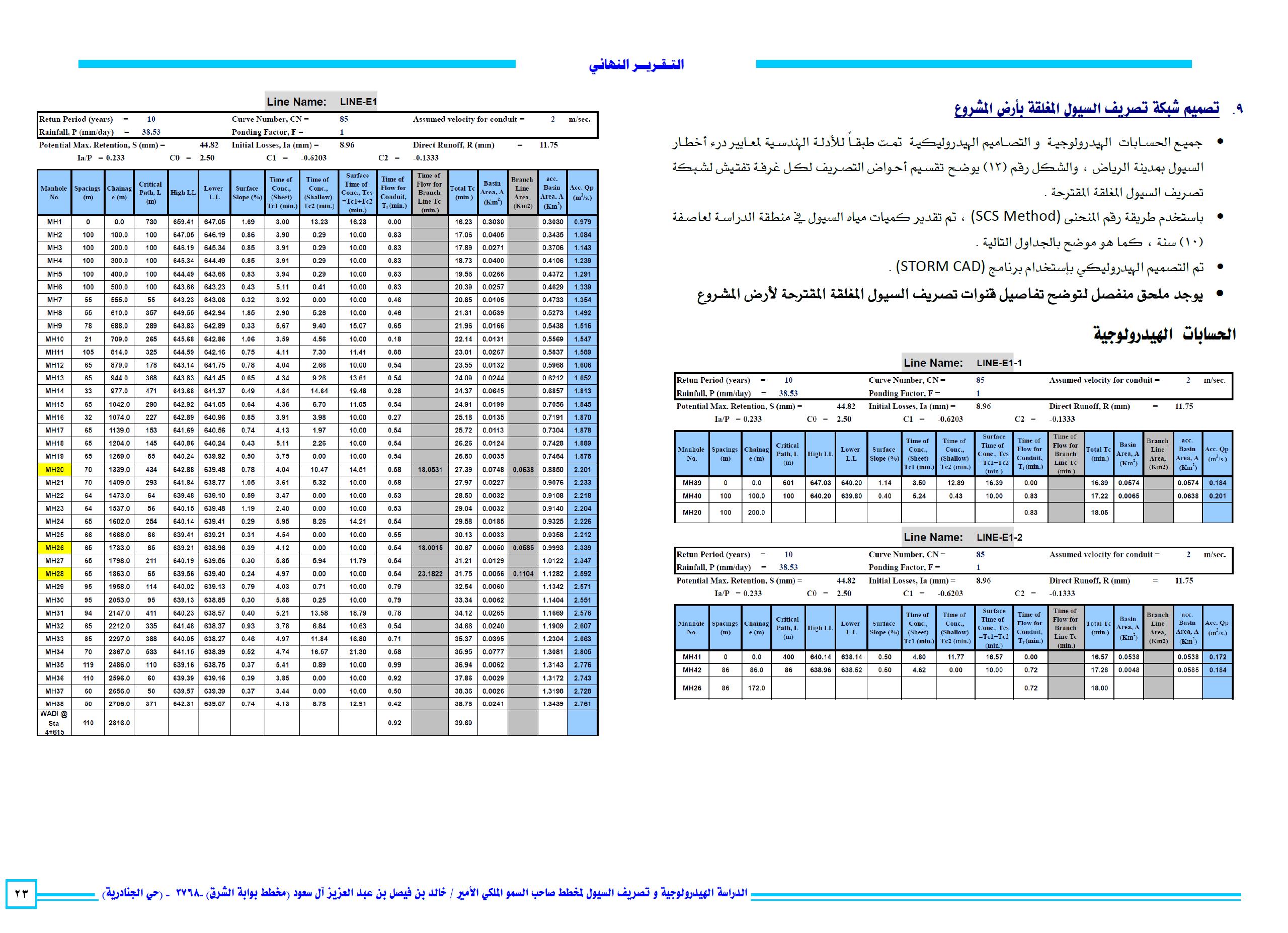
The project consists of planning the land of His Royal Highness Prince / Khalid bin Faisal bin Abdul Aziz Al Saud, a residential and commercial plan. The project land is located in Janadriyah district northeast of the city of Riyadh, the plan area is 6.5 million m2
The study includes several stages, as follows:
- Phase I: the stage of gathering the necessary information to complete the study from the concerned authorities and conduct field visits to find out the environmental status of the plan.
- Phase II: Analyzing information, studying the area, ensuring the discharge of floods from the plan and adjacent areas, proposing solutions for the discharge of the plan floods, and addressing the impact of neighboring plans on the plan
- Phase III: the stage of designing and preparation of the report and the plans.
- Phase IV: the stage of submitting the report to the concerned authorities and adopting it.
The hydrological study report includes:
- • Introduction to the project and description of the study area
- • Description and analysis of the cadastral survey for the project land topography and field visits to the site
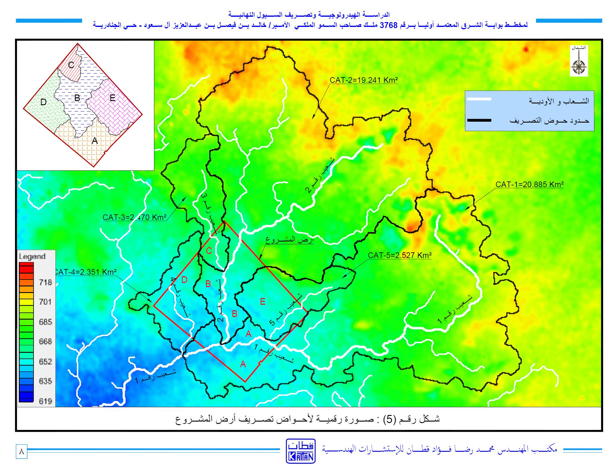
- • Sheebs and valleys passing by and nearby the plan land and their own drainage basins
- • Morphometric characteristics of sheeb and valleys drainage basins
- • Metrological characteristics of the city of Riyadh
- • Estimating the amount of flood for the project area and how to discharge them
- • The mechanism of discharge of flood water for the project land and the surrounding lands
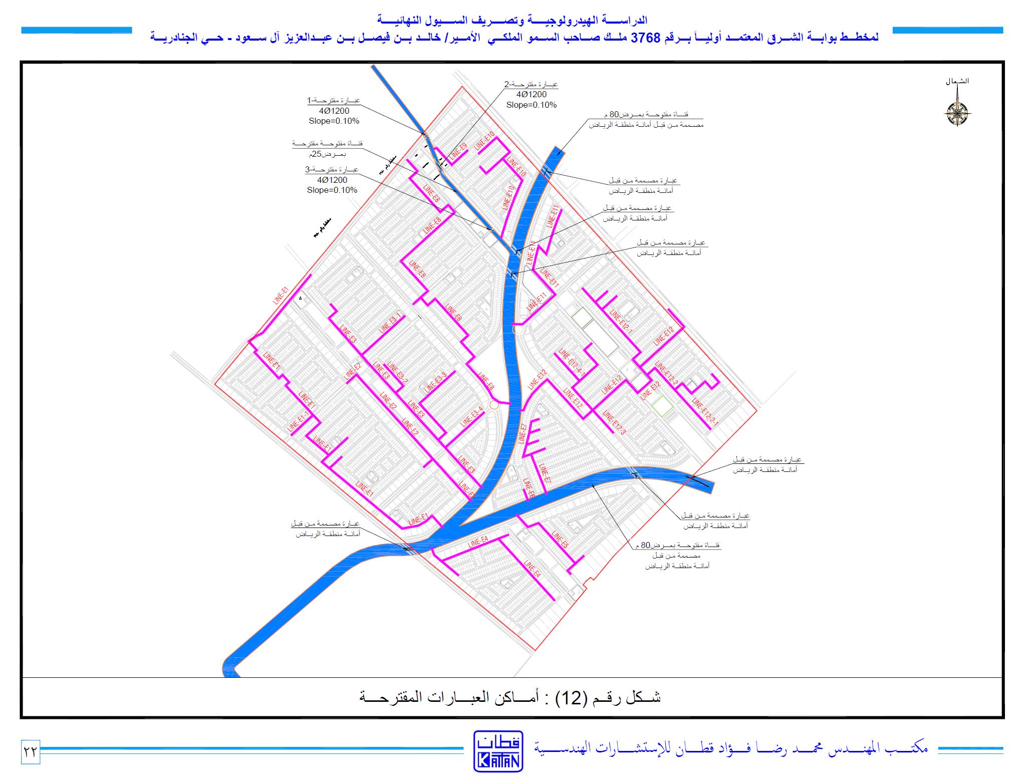
- • Designing sheeb and valleys passing by the project land
- • Designing a closed flood discharge network in the project land