
| Cadastral and Construction Surveying Project for Al- Dhahirah region | |
|---|---|
| Site | Riyadh - Riyadh neighborhoods Site |
| Client | Al-Riyadh Development Company |
| Type of work | Cadastral and topographic surveying |
A brief overview of the work
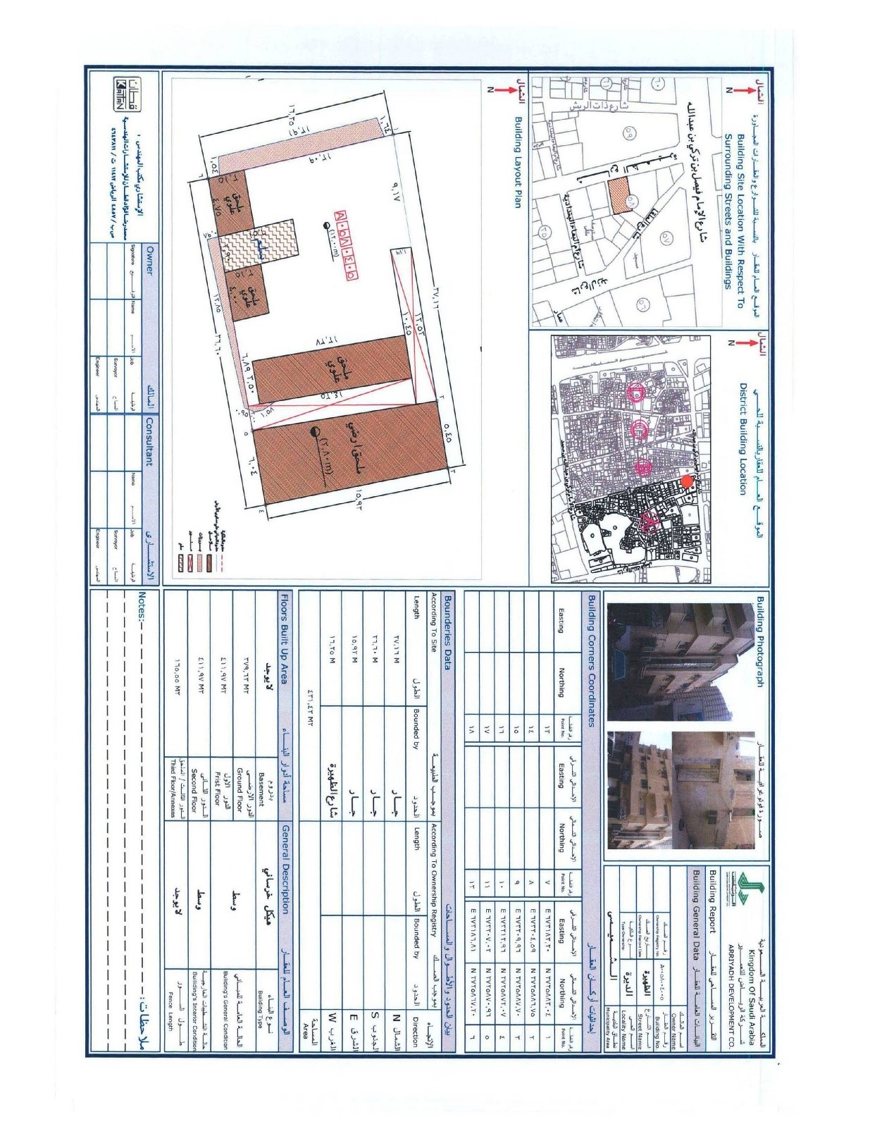
This project is one of the most important economic and cultural development projects in the capital Riyadh, where Al-Dhahirah region (800,000 m2) in central Riyadh will be under development at the highest technical level and according to the highest planning standards and international engineering. The office was commissioned by Al-Riyadh Development Company to conduct a full urban survey of the area, which included cadastral and urban reports for each individual property supported by pictures. The company will enable the valuation of the properties to be removed so that the owners will be indemnified or admitted as shareholders in the project with the value of their properties.
The work included the following:
- • Integrated cadastral surveying works for the property's limits of buildings, backyards and land space and collecting all the data of the owners, with the description of real estate and calculation of all coordinates, and making description cards for all cadastral points.
- • Urban surveying works to fill the required forms and photographs, and the number of the real estates reached (1400 real estate).
- • Downloading all works on AutoCAD diagrams with different layers for each work item.